
Trace a Smith County Street
Begin with the situs, the physical location of the property, rather than a person’s name. Smith County keeps the appraisal, tax, deed, map, and historical directory paths in separate systems. That split matters. An owner address in a tax result is a mailing destination, and a parcel card is not a household roll. Moving through the records in order makes it easier to preserve what each source actually supports.
The practical street directory sequence is address to owner, owner to deed, deed to voter evidence, then address history. The voter portal is a person and registration lookup, not a map of a whole street. It is useful only after a name is grounded in a separate record, and protected addresses may be withheld.
- Enter the street number and name in the Tax Assessor-Collector property-location mode, omitting the street type and direction as the portal instructs.
- Use the returned property location to compare the tax owner and mailing address with the SCAD appraisal account and parcel map.
- Search the owner as a grantee in the County Clerk index, then record the deed date, document number, and legal description before following an earlier party.
- When a name needs registration confirmation, use Texas My Voter Portal with its permitted person-based search methods rather than treating a street as a voter list.
- For an older household trail, request or consult Tyler and Smith County Kriss Kross or Criss Cross directories by street number and year.
Each step adds a different kind of evidence. Keep the account number, recorded document number, and date beside the address so similarly named people or altered parcels do not get joined by guesswork.
Use Smith County Street Situs
The Smith County Tax Assessor-Collector search is the clearest local starting point for an address. Its help separates owner address from property location. The first is the mailing address used for tax correspondence. The second is the actual situs address. For the Smith County street directory, choose property location and use the number plus street name, without an avenue, lane, drive, or direction suffix.
| Tax search field | Entry type | Use for street work |
|---|---|---|
| Search By | Selector | Help identifies Account Number, Owner Name, Owner Address, and Property Location. |
| Search | Text | Required for the chosen mode; property location uses a street number and name. |
| Include Inactive Accounts | Yes or No | Optional status control for a past or inactive account. |
| Pay Status | Selector | Both, Paid, or Unpaid. |
| Security Check | Challenge field | Required before submission. |
The Tax Assessor-Collector search screen shows the account, owner, and property-location paths used to separate a mailing clue from the actual address.
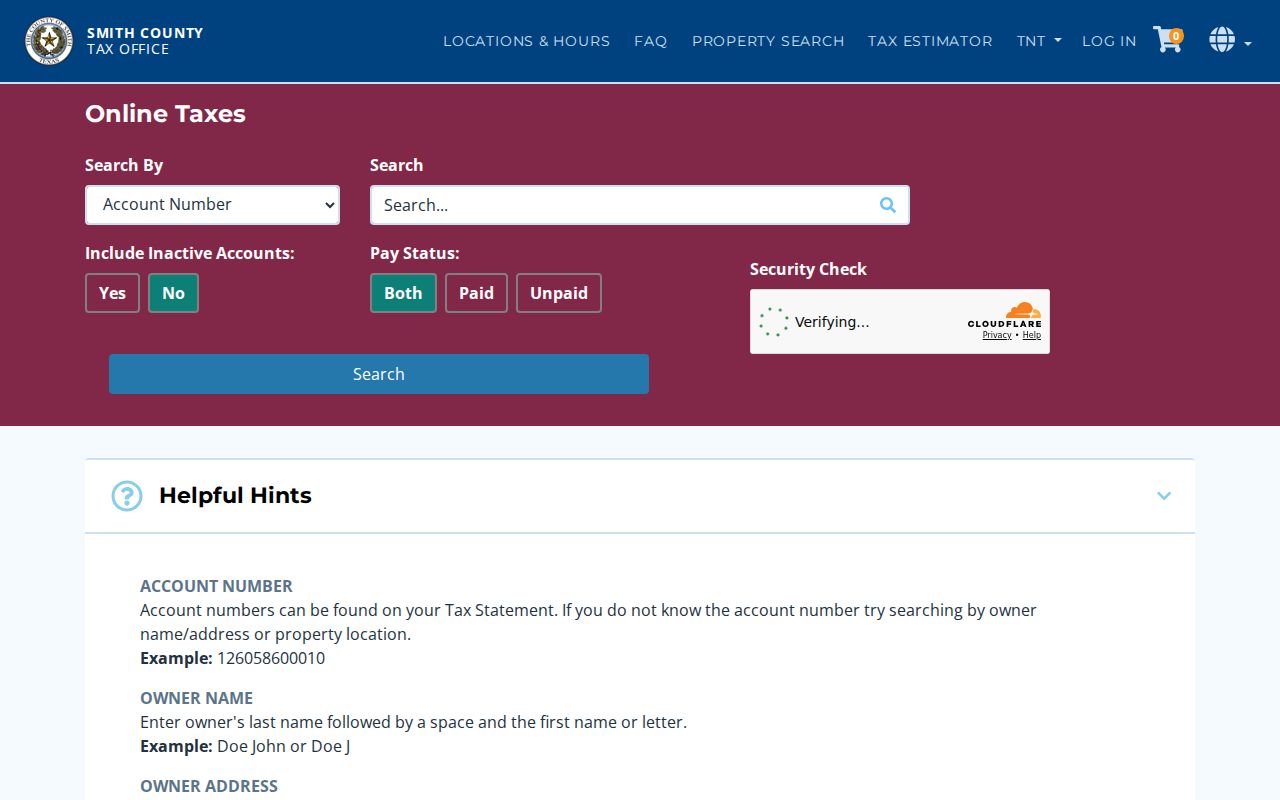
A result still needs confirmation from the parcel and recorded documents. The tax portal’s fields describe an account, not every person connected with an address.
Note: Record both the situs and mailing address because a difference between them can be routine and does not establish a move.
Map a Smith County Street
Smith County Appraisal District provides the property-search gateway, mapping links, exemption information, and public-inquiry tools. Its interactive map can be reached through the SCAD map application; a direct map URL may carry a parcel find parameter. Use the map to read parcel shapes, roads, and the relation between a street segment and its surrounding lots. SCAD warns that map boundaries are approximate and are not an on-the-ground survey.
The map is a bridge, not a resident list. A map click may expose a parcel or account link, while city and county layers can add district, zoning, or flood context. The local City of Tyler ArcGIS service includes zoning layers for Bullard, Lindale, Troup, Whitehouse, and Winona. Dynamic controls differ by application, so save the source date and parcel identifier when comparing a street over time.
SCAD Property Search is the source for the appraisal gateway shown here.
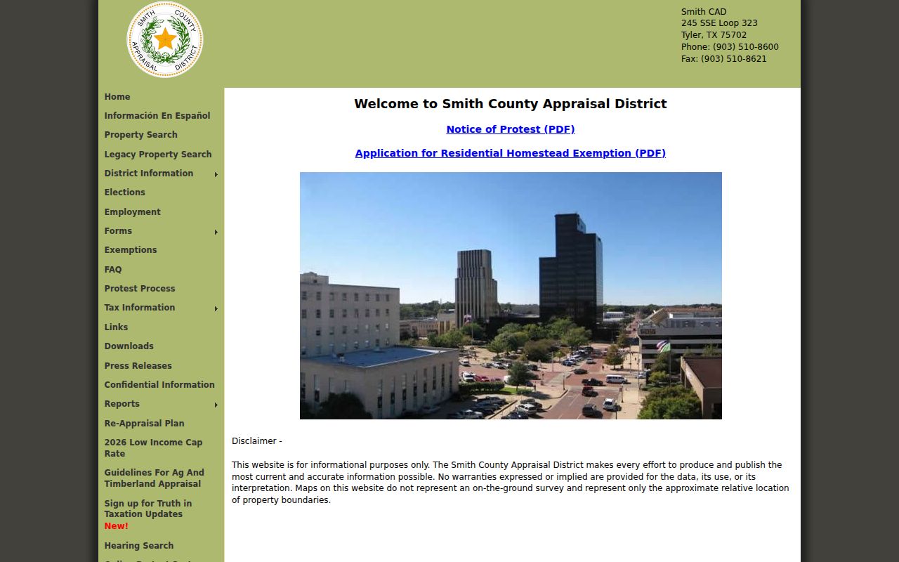
The gateway separates property lookup and mapping from the Tax Assessor-Collector account search, so the same street may need both official paths.
Follow Smith County Street Deeds
The Smith County Clerk Official Public Records Search supplies the title side of a street search. Its quick and advanced search tools accept a broad term, recorded-date range, date presets, and an index-only or index-and-OCR scope. A term can be a grantor, grantee, subdivision, document type, or document number. In index mode, several words are searched individually; the OCR scope treats multiple words as a phrase.
Search the present owner as grantee, inspect the instrument type, recording date, document number, party role, and legal-description text available in the result, then search the seller as an earlier grantee. A legal description is more dependable than a street address when a parcel has been split, merged, replatted, or assigned a new street number. A linked preview or purchased copy is not the same as a certified record.
The recorded index does not publish an online start year. For an older Smith County street trail, the Texas State Library and Archives Commission microfilm guide documents deed records from 1846, index reels for 1846–1888 and 1888–1901, and deed volumes through 1906. The County Clerk and historical microfilm path remain necessary when the live portal stops short of an earlier instrument.
Note: Treat every index row as a pointer to an instrument, then read the deed and legal description before claiming a parcel connection.
Compare Smith County Street Records
A complete Smith County street directory relies on several address-keyed sources. Some describe ownership, some show land geometry, and some preserve a dated municipal event or historical name. The table keeps those roles distinct and includes the fallback for a portal that lacks a public search result.
| Address record | Local keeper | Useful connection | Access route |
|---|---|---|---|
| Appraisal account | SCAD | Owner, account or parcel, values, exemption indicators, and map references when shown | Property search, map, office, or request |
| Tax account | Tax Assessor-Collector | Owner mailing address, property location, account status, and paid or unpaid status | Public tax search |
| Parcel map | SCAD, county, or city map service | Parcel shape, road context, districts, and map-linked account clues | Interactive map; boundaries are approximate |
| Deed or plat index | County Clerk | Recorded parties, instrument date and type, lot or subdivision description | Official records portal, deed books, or microfilm |
| Permit or inspection | Tyler Development and Planning | Address-based work, trade permits, inspections, and related dates | eTRAKiT or ProjectDox; PIA fallback |
| Code case | Tyler Code Enforcement | Address, category, date, and status | Department or request for an existing case |
| Criss-cross directory | Tyler Library or Historical Society | Historical street-number and householder or telephone entries | Appointment and staff-assisted research |
Voter data adds a separate, limited registration layer. Texas makes specified registration fields public, but My Voter Portal is not a street browser, ballot choices are not public, and protected addresses are withheld. A narrow official request can be appropriate for an existing, identifiable record, but an office need not create a new street-wide compilation.
Check Smith County Street Permits
Tyler Development and Planning names eTRAKiT and ProjectDox for building, pool, roof, electrical, plumbing, zoning, variance, subdivision, and infrastructure work. For a Tyler address, a permit can add a dated construction or inspection sequence. The city describes a workflow that opens a permit, checks linked trade permits and inspection details, and uses more-info controls for correction notes.
Tyler Code Enforcement also works from an address, but no public case-search interface was confirmed in the research. Ask the department or use the city’s public-information channel for an existing case, with a date range and street address. Code records can provide municipal context. They do not identify a complete household, and the reporter’s identity is not disclosed.
Place Smith County Street Jurisdiction
One street can cross more than one records authority. Tyler directs address-limit checks to SmithCountyMapSite.org. Smith County’s subdivision rules distinguish Tyler Zone 2, which is city controlled, from Tyler Zone 3, which is county controlled. Other municipal and unincorporated areas have their own authority pattern. This geography explains why a permit, plat, zoning file, or code record may sit with Tyler for one parcel and the county for another.
Postal city names create another layer of confusion. A Tyler mailing city, a Smith County parcel, and a municipal jurisdiction do not always match. Compare the situs, legal description, map jurisdiction, and record keeper before deciding which office should receive a request.
Note: Start a permit or zoning request with the parcel’s map jurisdiction, because a postal city name alone does not select the custodian.
Read Smith County Street Entries
For a past address, the street directory shifts from parcels to printed address entries. The Smith County Historical Society directory holdings cover Tyler and Smith County volumes from 1882 through 1999, with gaps and different publishers. Tyler Public Library also holds Tyler and Kriss Kross directories. Read the street or householder section in number order, then use the alphabetical section to look for the fuller listing available in that year.
The Historical Society’s archives are appointment-only, do not permit browsing or public photography, and require staff to pull material from a detailed topic. The Tyler Public Library Local and Family History Room has appointment research, microfilm tools, a scanner, and newspaper holdings. For directory-year detail and publisher runs, use the Smith County directory book rather than treating a past address entry as current proof.
Directories reflect their compiler, date, and coverage. Pair an entry with a deed, tax card, permit, census record, obituary, or newspaper before drawing a continuous street history.
Define Smith County Street Terms
Address research becomes more reliable when the same terms are used across the tax portal, appraisal card, deed index, and map. The four terms below describe different parts of the record trail, not different ways to prove current presence at an address.
- Parcel
- A mapped tract or tax account used to identify land for appraisal and tax purposes.
- Situs address
- The physical property location, distinct from an owner’s mailing destination.
- Plat
- A recorded map that can connect a subdivision, lot, block, roads, and a legal description.
- Criss-cross directory
- A reverse-style historical directory arranged by street number or address, often with a householder or telephone entry.
A lot, block, subdivision, survey, or metes-and-bounds description may be the continuity key when the street wording changes. Preserve it exactly as the instrument displays it.
Reach Smith County Street History
Older address work needs an offline route. The live Clerk index is current but does not state when its online run begins. The Texas State Library and Archives Commission guide for Smith County identifies deed material beginning in 1846 and supplies the early index-reel and volume path. County Records Services, the County Clerk, the library, and the Historical Society can help route a specific earlier volume, reel, document number, or record group.
Historical maps can supply the street and building context. The 1902 Tyler Sanborn series has 14 public-domain sheets at the Library of Congress. It can show a street form, structure, and nearby buildings, but not a resident name. The 2025 Smith County Historical Atlas adds landmarks, historic routes, and more than 200 cemeteries as context for an older road or community name.
Note: A missing online row can signal a different index or offline volume, not the absence of a recorded Smith County instrument.
Limit a Smith County Street Directory
A Smith County street directory cannot show every person attached to an address. Parcel and tax records identify an account and owner-of-record information. Deeds identify recorded parties and land descriptions. Historical directories record dated entries with gaps and compiler limits. Public voter records have protected-address and identifier rules, and the portal does not turn a street into a complete roster. DMV addresses, utility customer records, delivery records, and private association membership lists are not ordinary public sources.
When an existing government record is not online, use the Smith County Public Information Act process or the proper city channel. Describe the specific record, date range, parcel, street, or case number sought. Texas governmental bodies generally provide public information promptly or give written notice within ten business days if more time is needed, but they do not have to create a new record or perform open-ended research.
Lawful use. Smith County address records can support personal, lawful research about property, family history, and local history. Do not use them to stalk, harass, intimidate, or harm any person.